
Les meilleurs sentiers de randonnée en Crète
Ernest ·
Les dix marches ci-dessous couvrent l'éventail de la randonnée en Crète, de la descente de 15,7 km de la gorge de Samaria — 1 230 m de perte nette d'altitude, environ six heures sans longues pauses — à la marche horizontale et douce sur le plateau de Lassithi. Samaria est la plus longue et la plus punitive ; Imbros, à 8,3 km et environ trois heures sur une ancienne voie muletière, est celle que la plupart des randonneurs disent ensuite avoir préférée ; Aradena est l'exception technique, 6,8 km de sauts de blocs et de recherche d'itinéraire qui prennent quatre à cinq heures ; et le Psiloritis est la seule vraie ascension de montagne, 9–12 km aller avec environ 1 300 m de dénivelé jusqu'au sommet Timios Stavros à 2 456 m. Tout le reste — Agia Irini, Preveli, Richtis, Kedrodasos, Lassithi, la côte d'Elounda — se situe entre deux et quatre heures et se choisit pour le caractère plutôt que pour la difficulté.
En un coup d'œil
- Randonnée la plus longue
- Gorge de Samaria — 15,7 km avec 1 230 m de descente nette
- Durée de marche à Samaria
- Environ 6 heures sans longues pauses
- Gorge la plus facile
- Imbros — 8,3 km, environ 600 m de descente, à peu près 3 heures
- Randonnée la plus dure
- Aradena — 6,8 km de sauts de blocs et de recherche d'itinéraire en 4–5 heures
- Point le plus haut
- Timios Stavros sur le Psiloritis, 2 456 m
- Ascension du Psiloritis
- 9–12 km aller, environ 1 300 m de dénivelé, 6–8 heures
- Eau pour le Psiloritis
- Un minimum de 3 litres par personne, plus des vêtements en couches
- Point le plus étroit de Samaria
- Les Portes de Fer, larges de 3–4 m avec des parois de plus de 300 m
La marche en Crète est inhabituellement variée pour une île. En quelques heures de route, vous pouvez descendre une gorge de 1 230 m, progresser dans un canyon encombré de blocs, patauger dans une rivière à travers une palmeraie native, ou monter au-dessus de 2 400 m sur du calcaire ouvert. Voici dix itinéraires, chacun avec ses vrais chiffres, et une note honnête sur ce que chacun vous demande.
Comment les sentiers se comparent
| Itinéraire | Distance | Descente / gain | Durée | Difficulté | Saison |
|---|---|---|---|---|---|
| Gorge de Samaria (Xyloskalo → Agia Roumeli) | 15,7 km | −1 230 m | ~6 h sans longues pauses | Difficile | Marches guidées de mai à octobre |
| Gorge d'Imbros (Imbros → Komitades) | 8,3 km | −600 m | ~3 h | Facile | Ouverte toute l'année ; à éviter après de fortes pluies |
| Gorge d'Aradena (Aradena → Marmara Beach) | 6,8 km | −500 m | 4–5 h | Difficile, technique | Conditions sèches uniquement |
| Gorge d'Agia Irini (Agia Irini → Sougia) | 7,5 km | −450 m | 3–4 h | Modérée | Printemps à automne |
| Forêt de palmiers de Preveli (Preveli → Preveli Beach) | 4–6 km | Minimal | 2–3 h | Facile | Toute l'année ; la profondeur de la rivière change selon la saison |
| Gorge de Richtis (Exo Mouliana → Richtis Beach) | 4,2 km | −350 m | 2–3 h | Facile sous le pied, glissante partout | La plus humide et la plus glissante en hiver et au printemps |
| Mont Psiloritis (sommet Timios Stavros) | 9–12 km aller | +1 300 m | 6–8 h | Difficile, exposé | Fin de printemps au début de l'automne |
| Marche côtière de Kedrodasos | ~5 km | Minimal | 2–3 h | Facile, pleinement exposé | Mieux tôt le matin ou en fin d'après-midi |
| Marches du plateau de Lassithi | 5–12 km | Faible à modéré | 2–4 h | Facile | Vert au printemps, chaud et aux couleurs plates en fin d'été |
| Elounda → presqu'île de Kolokytha | 6 km | ~150 m | 2–3 h | Facile, pleinement exposé | Mieux tôt le matin ou en fin d'après-midi |
Les chiffres de distance, de dénivelé et de durée viennent des descriptions d'itinéraire ci-dessous. La colonne saison reflète le moment où nous guidons la marche, ou — pour les itinéraires que nous ne guidons pas — les conditions que le terrain implique. Le parc national de Samaria lui-même ouvre à des dates fixées chaque année par le service forestier, alors vérifiez avant de voyager.
Gorge de Samaria : distance, descente et le poids de l'échelle
Marcher dans Samaria est un exercice d'endurance déguisé en randonnée pittoresque. Dès les premiers pas à Xyloskalo, haut dans les Montagnes Blanches, le sentier fixe son caractère sans excuses. La descente commence tout de suite, et elle ne s'arrête jamais vraiment. Des marches de pierre, lissées par des décennies de bottes, tombent brutalement dans la gorge, forçant le corps à s'adapter avant d'être échauffé. Les genoux prennent la charge tôt, et les randonneurs qui précipitent cette section le sentent des heures plus tard.
Ce qui surprend le plus de gens n'est pas la difficulté des sections individuelles mais l'effet cumulatif de la distance. Le milieu de la gorge paraît sans fin — une longue procession de pierre, de gravier et de lit de rivière sec qui demande de l'attention à chaque pas. Quand les Portes de Fer apparaissent, la plupart des randonneurs sont déjà fatigués. Le passage étroit est dramatique et humiliant, mais bref. Le vrai défi vient ensuite, quand la gorge s'ouvre et que les kilomètres restants s'étirent plats et exposés vers la mer.
Les sources d'eau paraissent rassurantes sur les cartes mais sont saisonnières et peu fiables, surtout plus tard dans l'année. Atteindre Agia Roumeli est moins un finish triomphal qu'une libération silencieuse.
L'itinéraire en cinq sections
| Section | km | Ce qu'elle vous fait |
|---|---|---|
| 1. De Xyloskalo au fond de la forêt | 0–2 | Marches de pierre raides avec des contremarches inégales et une charge constante vers le bas sur les genoux. L'air froid du matin est trompeusement confortable. La plupart des randonneurs partent trop vite ici, et cette section décide de ce que les articulations sentiront plus tard |
| 2. Descente forestière et lit de rivière | 2–8 | La gorge s'ouvre un peu dans le pin et le cyprès. Le terrain alterne entre sol tassé et pierres meubles, avec de fréquents micro-ajustements d'appui. Les sources peuvent être sèches tard dans la saison. C'est là que les ampoules commencent si les chaussures sont mauvaises |
| 3. Zone de fatigue à mi-gorge | 8–12 | Le point bas psychologique : marche répétitive sur de la pierre dure, chaleur qui rayonne des parois, ombre réduite. Les sections plates épuisent bien plus que les gens ne s'y attendent une fois déjà fatigués |
| 4. Portes de Fer | 12–13 | Le point le plus étroit et le plus dramatique — la gorge se referme à 3–4 mètres avec des parois qui montent à la verticale sur plus de 300 m. L'air paraît immobile et lourd. Court, mais mentalement intense |
| 5. Sortie vers Agia Roumeli | 13–15,7 | Plat, exposé, punitif. L'exposition au soleil est maximale, les pieds sont déjà compromis et la densité de foule augmente. La plupart des incidents liés à l'épuisement se produisent ici |
Ce qu'elle vous demande
La contrainte principale porte sur les genoux, les chevilles et les plantes des pieds. Le défi mental est la monotonie plus la pression de la foule. Les trois erreurs courantes sont de partir trop vite, de porter trop peu d'eau et de porter des chaussures à semelle souple.
Gorge d'Imbros : mouvement, rythme et échelle humaine
Imbros offre une relation très différente avec le paysage. Là où Samaria submerge par la taille, Imbros invite à un mouvement régulier et à l'observation. Le sentier suit une ancienne voie muletière, et cette histoire se voit : les descentes sont graduelles, les virages sont logiques, et le terrain paraît négocié plutôt que conquis.
Le gravier et la terre tassée dominent sous le pied, si bien qu'un rythme de marche naturel se développe presque tout de suite. Quand les parois se referment, la gorge crée de longs couloirs de pierre qui canalisent l'air frais et amplifient le son — les pas résonnent doucement, le chant des oiseaux voyage clairement, la conversation porte plus loin que prévu. Les sections étroites où les parois se touchent presque au-dessus de la tête sont visuellement saisissantes, surtout quand le soleil coupe à un angle aigu, mais la gorge ne paraît jamais hostile. La fatigue s'accumule lentement plutôt que brusquement.
Sous le pied et au-dessus de la tête
Du gravier stable plutôt que de la roche meuble, un impact minimal des marches, un faible risque de se tordre une cheville — ce qui fait d'Imbros un bon choix pour les randonneurs qui se remettent d'une marche plus longue la veille. Les parois de roche agissent comme des tunnels de vent naturels et tiennent les températures bas. Les limites sont réelles mais gérables : eau limitée, quelques chutes de pierres après de fortes pluies, et exposition à la chaleur près de la sortie.
À qui elle convient
Aux débutants qui passent à des marches plus longues, aux voyageurs qui marchent plusieurs jours de suite, et à quiconque évite la surcharge des genoux. Imbros est souvent choisie comme suite à Samaria — et beaucoup de randonneurs avouent ensuite l'avoir préférée.
Gorge d'Aradena : silence, décision et descente contrôlée
Aradena ramène la randonnée à l'essentiel. Il n'y a pas d'introduction douce. Un moment vous êtes debout près du village abandonné d'Aradena en lumière ouverte, le suivant vous descendez dans un vide rocheux étroit où les règles changent complètement.
Ce n'est pas tant un sentier qu'une descente contrôlée à travers le chaos. Le progrès est dicté par les obstacles plutôt que par la distance : de gros blocs barrent le chemin, forçant des décisions à chaque virage. Le sentier, là où il existe, est une suggestion. Les mains sont souvent nécessaires, l'équilibre est constamment mis à l'épreuve, et une mauvaise ligne de descente peut mener à une impasse ou à une chute dangereuse. Il y a peu d'occasion de se détendre dans un rythme.
Le silence dans Aradena est saisissant — le son ne voyage pas comme dans les gorges plus larges, et l'absence de vent crée une sensation presque close. La chaleur reflète vers le haut depuis la pierre, et sans points de référence visuels clairs, le temps devient difficile à juger. Émerger à Marmara Beach, où la lumière s'ouvre soudain et où la mer apparaît sans prévenir, ressemble moins à finir une randonnée qu'à être libéré d'un état de concentration.
À qui elle convient
Une expérience du terrain non balisé et de la recherche d'itinéraire, des décisions calmes sous un stress physique et mental soutenu, et l'acceptation d'un progrès lent. L'une des randonnées les plus exigeantes mentalement de l'île.
Gorge d'Agia Irini : flux, ombre et marche soutenue
Agia Irini occupe un rare terrain intermédiaire : assez longue pour paraître substantielle, assez sauvage pour paraître authentique, assez structurée pour laisser le corps s'installer dans un rythme soutenu. Des passerelles de bois, des marches de pierre et des garde-corps apparaissent là où il le faut — non pour aseptiser l'expérience mais pour la guider.
La gorge est riche en végétation et l'ombre est plus constante que sur la plupart des itinéraires du sud. Le pin domine les sections hautes, cédant la place au maquis méditerranéen et aux herbes sauvages à mesure que le sentier descend. Ce qui la distingue, c'est la constance : le gradient surprend rarement, l'appui est prévisible, et l'environnement change lentement. Cela laisse de l'espace mental s'ouvrir — l'attention passe du regard sur chaque pas à la lumière sur la roche et à la température qui change quand la gorge courbe. Finir près de Sougia avec la mer en vue paraît naturel plutôt qu'abrupt.
Convient aux randonneurs intermédiaires qui veulent une longueur modérée sans contrainte extrême. Des chaussures à bonne adhérence sont recommandées pour les sections rocheuses occasionnelles.
Forêt de palmiers de Preveli : eau, mouvement et un paysage vivant
Cette marche est définie non par la roche ou le dénivelé mais par l'eau. Suivre la rivière Megalopotamos est fondamentalement différent de marcher dans une gorge : le sol est plus doux, l'air plus humide, le paysage constamment en mouvement. Les bancs de sable se déplacent avec les saisons, les traversées de rivière changent de profondeur du jour au lendemain, et des sentiers qui existent une année peuvent disparaître la suivante.
Marcher ici est plus lent et plus exploratoire. Les chaussures se mouillent. Les pieds s'enfoncent dans le sable. La rivière courbe de façon inattendue, révélant des peuplements denses de Phoenix theophrasti, le palmier-dattier natif de Crète, qui paraissent presque tropicaux contre les collines sèches autour. Le paysage sonore est l'eau, les insectes et le vent dans les feuilles plutôt que la pierre qui résonne.
Ce n'est pas une randonnée pour couvrir de la distance. C'est une marche à travers un écosystème, où la patience compte plus que le rythme. Atteindre Preveli Beach, où l'eau douce rencontre le sel, est la conclusion naturelle. Pas physiquement exigeant, mais cela demande de l'attention sur un sol mouillé et inégal — et idéalement des chaussures que vous ne craignez pas de tremper.
Gorge de Richtis : attention, humidité et ajustement constant
Richtis demande de l'attention d'une façon plus calme. Elle est plus courte que les randonnées célèbres de Crète, mais son caractère tient dans le micro-ajustement constant. L'eau est présente partout — qui suinte, goutte, coule. Des ponts de bois traversent des sections étroites, les pierres sont recouvertes de mousse, et le sol est rarement sec. Chaque pas demande du soin, surtout dans les zones ombragées où l'humidité n'évapore jamais tout à fait.
La cascade au cœur de la gorge est spectaculaire, et c'est aussi là que la prudence compte le plus. Les glissades arrivent ici non parce que le sentier est difficile mais parce qu'il paraît trompeusement sûr. Richtis récompense le mouvement lent et la conscience : elle n'est pas physiquement exigeante, mais elle rappelle que facilité et sécurité ne sont pas la même chose.
Mont Psiloritis : altitude, exposition et aucun abri
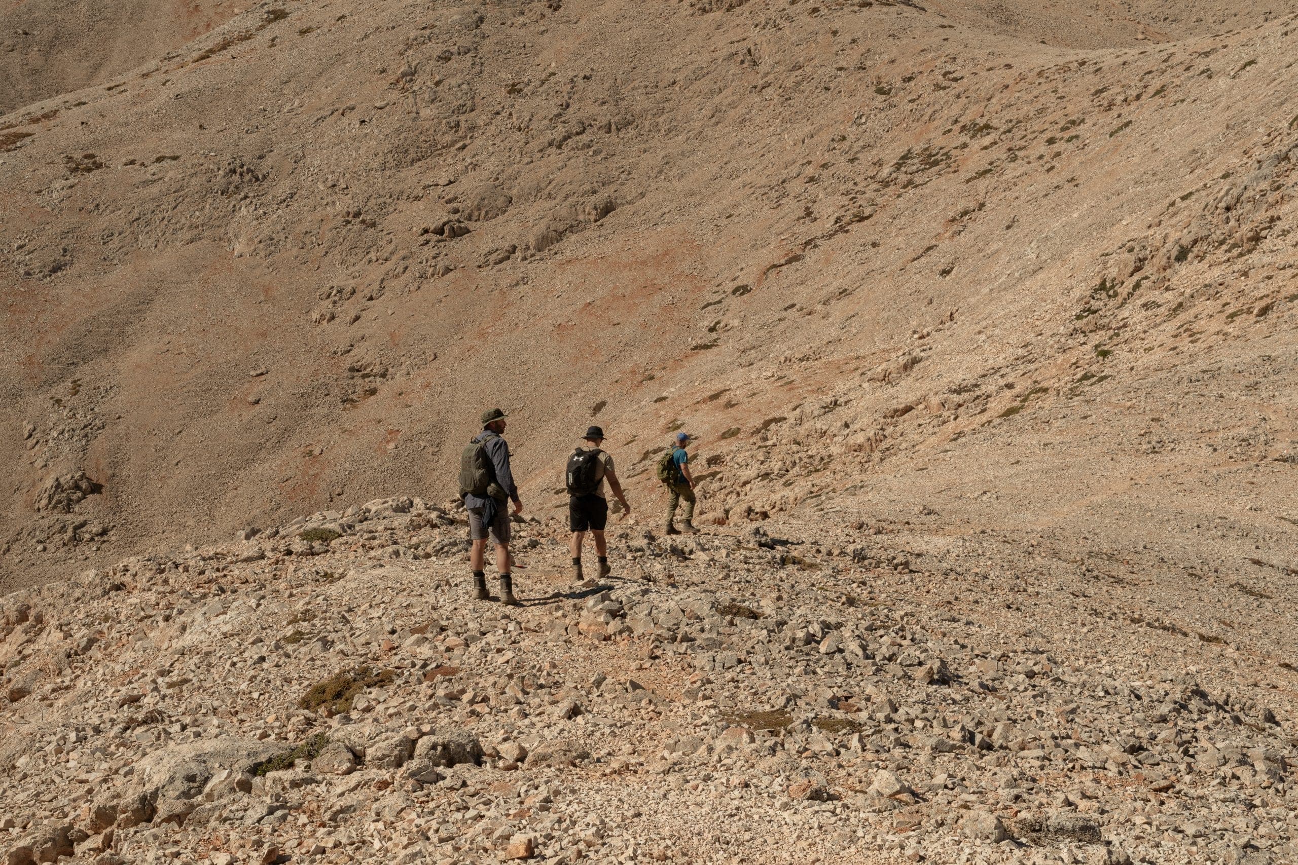
Grimper le Psiloritis est une entreprise entièrement différente de la marche en gorge. La montagne ne guide pas et ne protège pas — elle expose. L'ascension est longue, ouverte et souvent implacable. Les éboulis calcaires bougent sous le pied et le progrès se mesure en effort plutôt qu'en distance.
À mesure que l'altitude augmente, le paysage se simplifie : la végétation s'amenuise, la couleur s'évacue, l'horizon s'élargit. Le temps change vite. Les nuages se forment et se dissolvent sans prévenir, et le vent peut se lever soudain, dépouillant le corps de sa chaleur même en été. Le sommet Timios Stavros se dresse à 2 456 m, et s'y tenir — là où la mythologie place la naissance de Zeus — paraît contemplatif plutôt que célébratoire. La montagne accorde le passage ; elle ne félicite pas l'effort.
Ce qu'il exige
Une haute endurance, des compétences de navigation et une conscience du temps. Un minimum de trois litres d'eau par personne et des vêtements en couches. Pas adapté aux randonneurs occasionnels : c'est de l'alpinisme sans l'escalade technique, et une expérience des longues ascensions exposées est présumée.
Marche côtière de Kedrodasos : vent, sable et fragilité
Kedrodasos consiste moins à suivre un sentier qu'à se déplacer à travers un paysage vivant et exposé. Il n'y a pas de chemin formel, pas de début ni de fin clairement marqués par des panneaux. La marche se déploie de façon organique à travers des dunes, une forêt de genévriers bas et un rivage ouvert, façonné autant par le vent que par les pas.
Le sol change constamment : le sable doux cède la place à de la terre tassée, puis à des dalles de roche plates réchauffées par le soleil. Le progrès est plus lent que la distance ne le suggère, non parce que le terrain est dur mais parce qu'il demande de l'attention — chaque pas affecte un système de dunes fragile. Les genévriers poussent bas et tordus par des décennies de vent, il y a très peu d'ombre, et le soleil réfléchit fortement sur le sable et la pierre pâles. Les jours de vent, l'air lui-même devient partie de l'effort.
Quand l'eau turquoise peu profonde d'Elafonisi entre en vue, le contraste paraît presque surréaliste. Marchez-la tôt ou tard dans la journée, et laissez aussi peu de trace que vous le pouvez.
Plateau de Lassithi : le temps humain écrit dans la terre
Marcher sur le plateau de Lassithi est un drame horizontal. Le plateau s'ouvre large sous les montagnes Dikti, un bassin haut façonné pendant des siècles par l'agriculture plutôt que par l'érosion. Les chemins serpentent entre champs, murs de pierre et villages épars, suivant souvent des routes qui existent simplement parce qu'elles ont toujours existé. Les moulins à vent, certains restaurés et d'autres s'effondrant doucement dans le sol, marquent le rythme du paysage.
La marche est douce, presque trompeusement, mais l'altitude apporte un air plus frais et un sentiment de distance par rapport à la côte. Les champs s'étirent sans interruption, et l'absence d'enceinte laisse l'esprit vagabonder — les sons sont le vent dans les cultures, des chiens au loin, un tracteur occasionnel.
La saison compte ici plus que sur n'importe quel autre itinéraire de cette liste. Au printemps, la terre est verte et pleine ; en fin d'été elle sèche, les couleurs s'aplatissent, et marcher devient un exercice de gestion de la chaleur. Le même itinéraire paraît une marche différente selon le moment où vous le faites.
D'Elounda à la presqu'île de Kolokytha : lumière, horizon et eau ouverte
Cette marche côtière est définie par l'ouverture. Le sentier monte et descend doucement sur un sol rocheux, toujours assez près de la mer pour que l'horizon reste présent. Contrairement à une gorge, où la terre vous enferme, ici le paysage pousse vers l'extérieur.
Le sentier est informel mais intuitif, suivant les contours naturels de la côte. Le sol est rocheux mais gérable et le rythme est détendu, façonné plus par la chaleur et la lumière que par la difficulté technique. L'exposition au soleil est constante et même un vent doux paraît fort sur les étendues ouvertes.
Ce qui la rend mémorable, c'est l'atmosphère plutôt que l'effort. La lumière change quand les nuages bougent sur la baie, transformant l'eau du bleu profond au turquoise pâle en quelques minutes, et des spots de baignade apparaissent naturellement le long de l'itinéraire, découpant la marche en chapitres plutôt qu'en kilomètres. Elle fonctionne mieux tôt le matin ou en fin d'après-midi.
Choisir entre eux
Si vous n'avez qu'un jour et voulez la marche dont on parle, c'est Samaria — mais réservez-la en sachant que ce sont 15,7 km avec 1 230 m de descente et aucun raccourci une fois parti. Si vous voulez l'expérience de la gorge sans la punition, Imbros vous donne les mêmes couloirs de pierre en trois heures. Si vous marchez plusieurs jours de suite, alternez : une longue descente un jour, une rivière ou une marche côtière le lendemain. Et si vous voulez une montagne plutôt qu'une gorge, le Psiloritis est celui qui restera avec vous — à condition d'y aller préparé au temps qu'il peut produire à 2 456 m.
Bon à savoir
Quelle est la meilleure randonnée en Crète pour une première visite ?+
La gorge d'Imbros. Elle fait 8,3 km avec environ 600 m de descente et prend à peu près trois heures sur du gravier stable et de la terre tassée, donc vous avez l'expérience de la gorge à couloir étroit sans les 15,7 km et les 1 230 m de descente que Samaria exige.
Combien de temps prend la gorge de Samaria ?+
Environ six heures de Xyloskalo à Agia Roumeli sans longues pauses, sur 15,7 km avec 1 230 m de perte nette d'altitude. Les derniers 2,7 km, des Portes de Fer à Agia Roumeli, sont plats et pleinement exposés, et c'est là que se produisent la plupart des incidents liés à l'épuisement.
La gorge de Samaria est-elle en descente tout le long ?+
Oui, et c'est le problème. L'itinéraire descend 1 230 m de Xyloskalo au niveau de la mer, ce qui charge les genoux, les chevilles et les plantes des pieds dès les deux premiers kilomètres. Il ne faut jamais la sous-estimer simplement parce qu'elle descend.
Quelle gorge crétoise est la plus dure ?+
Aradena. Elle ne fait que 6,8 km avec environ 500 m de descente, mais elle prend quatre à cinq heures parce que le progrès est dicté par les blocs plutôt que par la distance. Elle exige de l'escalade à mains, une recherche d'itinéraire continue et une expérience du terrain non balisé — une mauvaise ligne de descente peut mener à une impasse ou à une chute dangereuse.
Faut-il des chaussures de randonnée pour les gorges crétoises ?+
Des semelles solides comptent plus que la hauteur de tige. Les chaussures à semelle souple sont l'une des trois erreurs courantes à Samaria, avec le départ trop rapide et le manque d'eau. À Richtis les surfaces sont moussues et mouillées partout, donc l'adhérence est la priorité ; à Preveli vos pieds seront mouillés de toute façon.
Quelle quantité d'eau dois-je porter ?+
Pour le Psiloritis, un minimum de trois litres par personne. Dans les gorges, les sources d'eau paraissent rassurantes sur les cartes mais sont saisonnières — les sources de Samaria et d'Imbros peuvent être sèches plus tard dans la saison, alors portez ce dont vous avez besoin plutôt que de compter sur le fait de les trouver.
Quelle est la meilleure période de l'année pour randonner en Crète ?+
De la fin du printemps au début de l'automne pour les itinéraires hauts, quand la neige a quitté les sommets et que le temps est établi. La marche en gorge est plus indulgente : Imbros fonctionne toute l'année, tandis que Richtis est à son plus humide et son plus glissant en hiver et au printemps. Sur le plateau de Lassithi, le printemps est vert et plein et la fin de l'été est sèche, chaude et aux couleurs plates.
Excursions citées dans ce guide
 Randonnée
Gorges de Samaria
5.0· 61 avis16 km depuis le plateau d'Omalos, à travers les Portes de Fer, jusqu'à la mer de Libye.
- 12h
- petit groupe · max 8
- mai–oct.
À partir de 350 €
Réserver cette excursion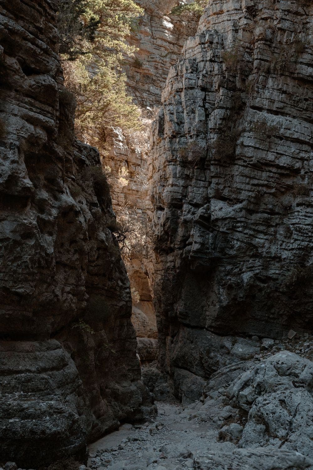 Randonnée
Imbros Gorge
5.0· 60 avisLa douce descente de 8 km depuis les Montagnes Blanches jusqu'à la mer de Libye.
- 6h
- petit groupe · max 8
- La plupart des jours
À partir de 290 €
Réserver cette excursion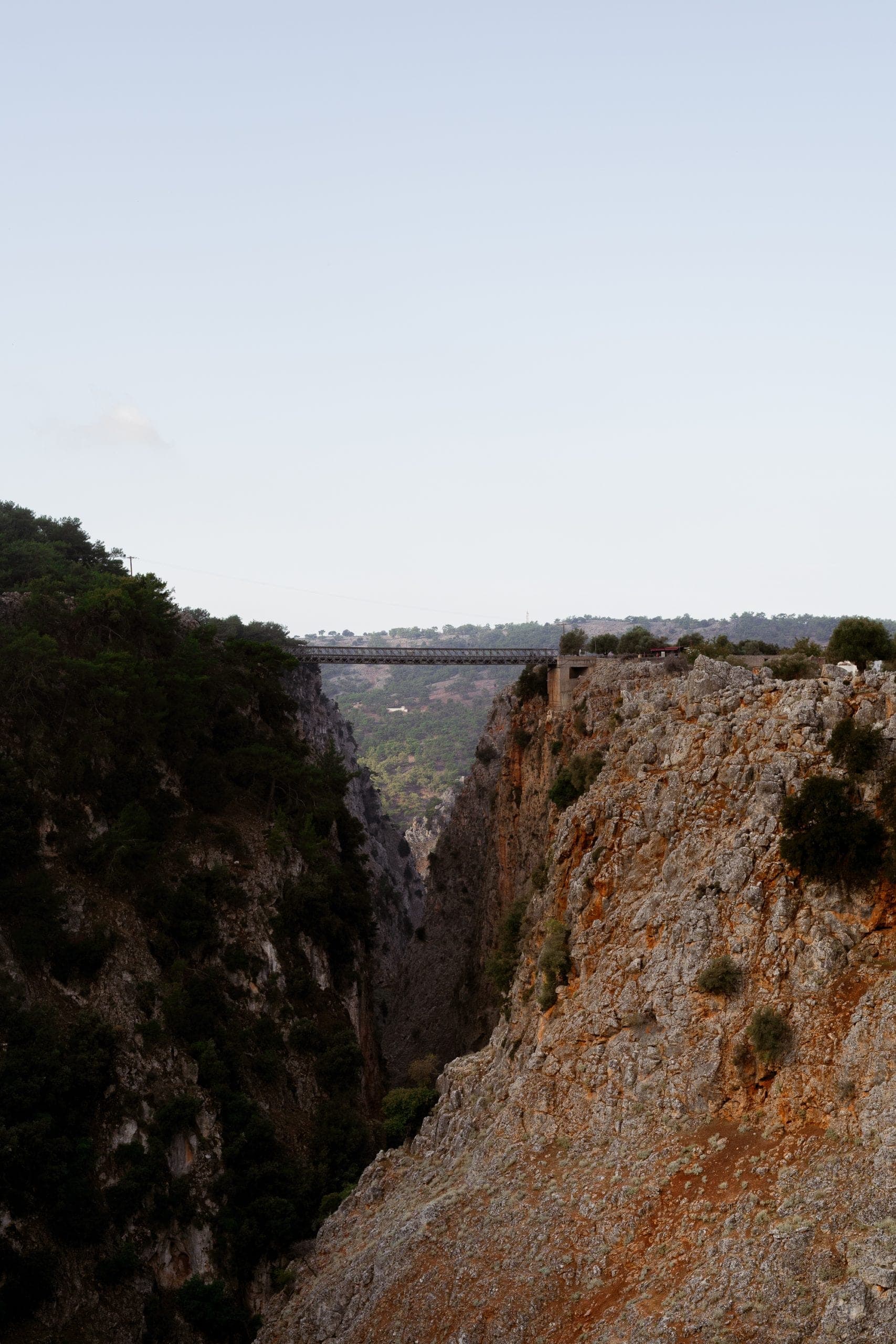 Randonnée
Gorges d'Aradaina et Marmara Beach
5.0· 58 avisUne descente sauvage de 520 mètres à travers Sfakia jusqu'à une baie aux parois de marbre sur la mer de Libye.
- 9h
- petit groupe · max 8
- Sur demande
Sur demande
Réserver cette excursion Randonnée
Sommet du Pachnes
5.0· 62 avisEn 4x4 dans les Madares, puis une randonnée de deux heures jusqu'au plus haut sommet des Montagnes Blanches.
- 9h
- petit groupe · max 8
- Sur demande
Sur demande
Réserver cette excursion